
Routes
Stallings Island (Guide Tours Only)


Route Length: 3-miles
Time: 2.5 Hours
Highlights: Feeding the Donkeys, Stevens Creek Dam, Whale Rock, Hissing Trees, Island Break
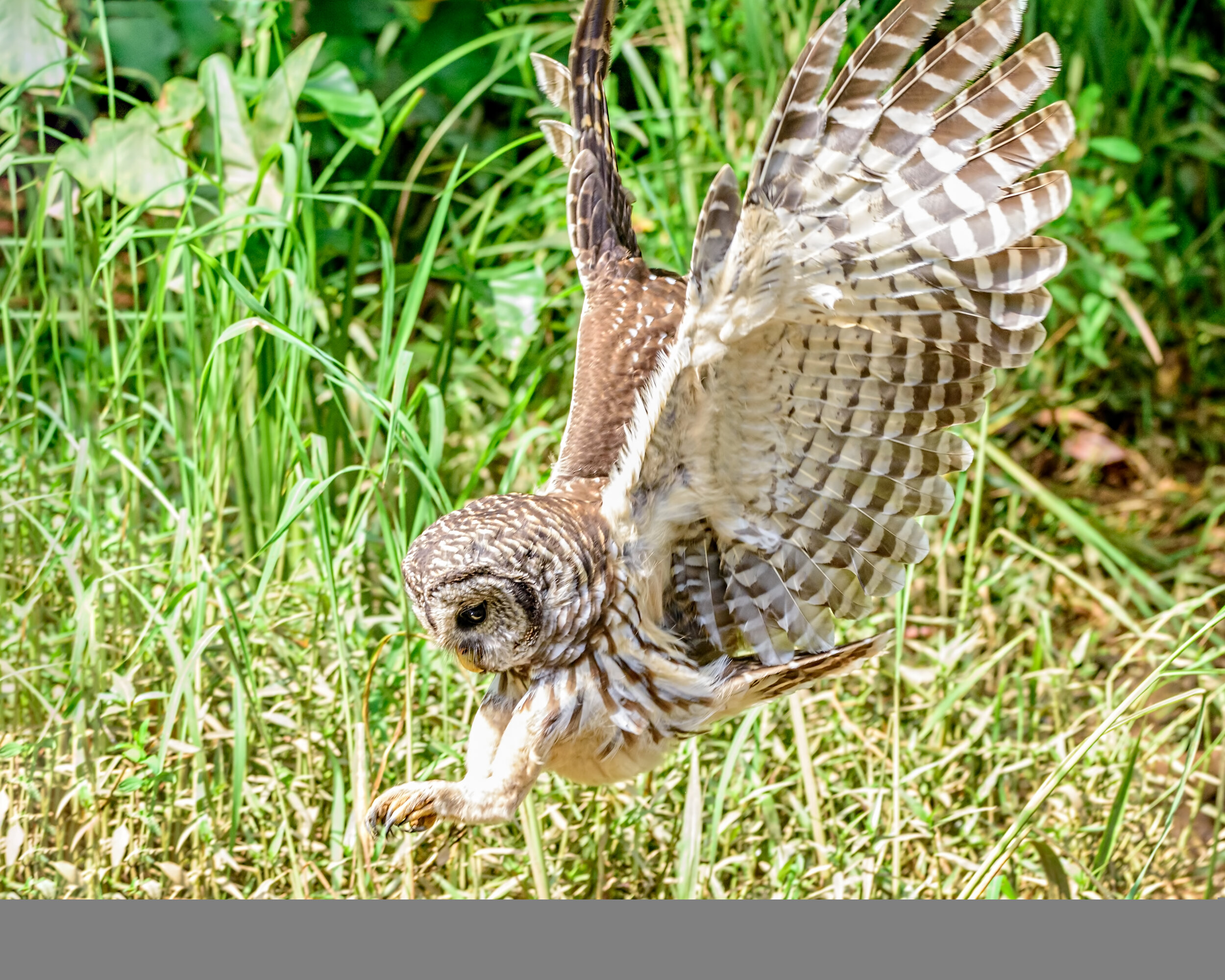
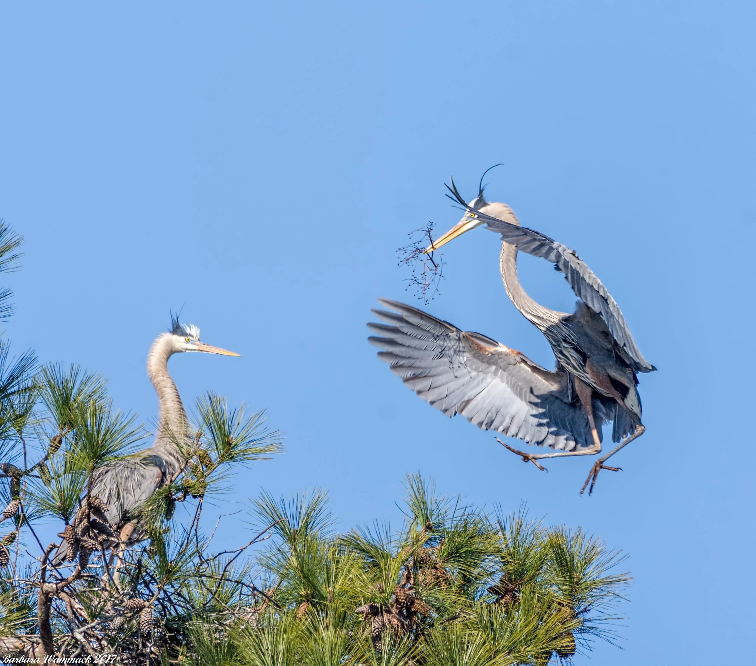
Common Sightings: Donkeys, Vultures, Snakes, Turtles, Osprey, Gar, Heron, Deer
Rare Sightings: Goats, Eagle
Best for: Intermediate Paddlers, Adventure Seekers, History Buffs, Snake Lovers, and anyone who likes to feed wild donkeys!
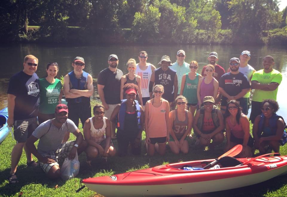
Stallings Island is the route that put CWT on the map!… as evidence shows with our many TV Show appearances out there. Some people refer to this island as “Donkey Island” for its friendly inhabitants, but this island has a much more important claim to fame. Stallings Island is actually the birthplace of pottery on the North America Continent! Roughly around 2500BC, the Stallings People roamed this area. Guests will get to hear a little bit of history on this route while exploring the most secluded & serene route in all of the Central Savannah River Area (CSRA).
After a quick safety briefing and group introduction, we will make our way north on this quiet stretch of river through a chain of islands referred to as “99 Islands”. We like to weave in and out of the islands to show the guests the various scenic views. During this route, the guides share fascinating stories of the historic culture of this area. Once we reach the southern tip of Stallings Island, we will start our search along the waters edge for the resident donkeys and goats. Guests are encouraged to bring vegetables or produce if they want to feed the animals that make their way down to our kayaks. After that, we then paddle along to a nearby sandy island to take a quick dip in the water and snap some pictures. We continue our paddle to get a close view of the Stevens Creek Dam, which is over 100 years old. This area offers some gorgeous views as the water mists down the dam. While here we also see Whale Rock which is an enormous rock coming out of the water that looks like a breaching whale. We will paddle along the dam to see turtles and Gar; an elongated, prehistoric-looking fish. Once on the South Carolina side of the river, we have a chance to approach two cypress tress we have dubbed as “The Hissing Trees” which were given their name for the constant snake activity. This is totally optional as we know some people hate to see snakes; these guests are welcome to hang back with the secondary guide. After scoping out the mostly lethargic snakes, we make our way back over to the Georgia side and weave and wind back through different islands to the same launch we started from.
*Note this route, at times, has a steady current and is not suitable for new or rusty paddlers. CWT only offers Guided Tours for this route.
Betty’s Branch
Route Length: 4-mile Short Route or 6-mile Loop
Time: 2 - 3.5 Hours
Highlights: Sandbar Visit, Iconic Train Trestles, Champions Retreat Golf Course, German Island Cut-Thru (High Water)
Common Sightings: Turtles, Osprey, Heron, Swallows, Snakes, Hawk, Deer, Owl
Rare Sightings: Wild Boar, Eagle
Best for: Families, Beginners, Bird Watchers, Swimmers, Sandbar-Goers
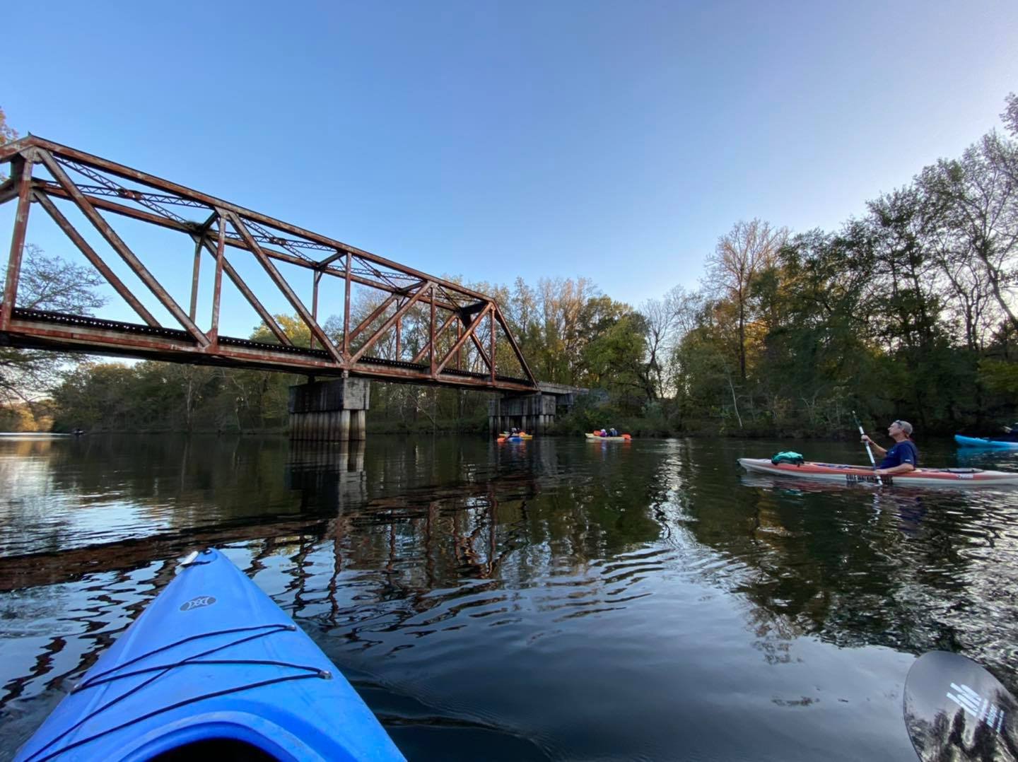
Betty’s Branch is where Cole’s love of kayaking began! As a teen, Cole and his friends spent many days playing at the sandbar and train tracks on this serene route. Betty’s Branch, also known as “Little River”, is a tributary to the Savannah River; it is divided by a long narrow 3 mile island called German Island.
If you are new to the sport of kayaking or the area, this is the best route for you as this route is very easy to do for many reasons. The water is calm so its easy to paddle. You also start and finish at the same boat ramp, so it is easy to navigate and plan your day (no shuttle needed). CWT often takes first time customers on Guided Tours and even offers unguided Kayak Rentals on this route. But don’t let this route fool you, this route is great for all experiences levels. Even the most veteran paddlers will enjoy the pristine sights and abundant wildlife on this paddle. Betty’s typically has the best variety of birds including Herons, Osprey, Canadian Geese, Hawks, Owl, Woodpeckers and more! And of course, you are going to see so many turtles, especially on sunny days!
After a quick paddle tutorial and group introduction, we make our way through Betty’s Branch (startubg at the boat ramp area) and into the Little River tributary. The first thing you will notice is the iconic, rusty train trestle which crosses Georgia to German Island to South Carolina. As we make our way upstream you will likely see other friendly boaters. After a mile or so, you will be arriving to the Sandbar! We love to take pitstops here to swim, play catch, and even enjoy a personally packed picnic. After a short stop, we paddle up to the Champions Retreat Golf Course. This course is the practice-round home of the Augusta National Women’s Amateur Tournament which is held every year before Master’s Week. Customers will get to watch a par 3 where the golfers must chip the ball over Little River to the green. It’s also fun to try to spot golfballs on the sandy bottom and let kids swim down to get them.
This route is also unique in the fact you have a few options on this route. Most guests turn around at the golf course and return to the launch for a 4 mile trip. More adventurous paddlers will enjoy making the entire 6-Mile “Loop” around the island. On high-water days, we can combine both and take our customers through the hidden “Cut-Through”!


Route Length: 5-mile downstream float
Time: 2 - 2.5 Hours
Highlights: Reed Creek Waterfall, Old Powder Works Chimney.
Common Sightings: Turtles, Otters, Osprey, Heron, Deer
Rare Sightings: Aligator
Best for: Relaxation Seekers, Floaters, History-Buffs, Turtle-Lovers
The Augusta Canal Trip is another route full of history. Built in 1845 as a source of power, water, and transportation; it is one of the only canals in the US that is still used for its original purpose. Shortly after construction, many factories were built and families flocked to Augusta for work. By the time of the Civil War, Augusta had become one of the South’s few manufacturing centers. This was an important factor in the Confederacy’s choice to construct the Confederate States Powder Works; the only buildings ever constructed by the government of the Confederate States of America. Other war industries established themselves on or near the Canal, making Augusta a critical supplier of ammunition and war materiel.
This route has a nice relaxing current from the start all the way to the finish. We like to make the analogy of a lazy river at a waterpark. With the current in play, this is a Point A to Point B route. CWT does not offer shuttles, so customers must bring 2 vehicles or organize a shuttle with a local company (we can assist in this). The route starts at the Savannah Rapids Pavilion and finishes 5 miles south at the Old Powder Works Chimney and the Kroc Center. Guest will enjoy this easy 2 to 2.5 hour float while spotting dozens on dozens of turtles and other wildlife. This waterway runs parallel with the Augusta Canal Towpath (Canal Trail); originally used by draft animals to pull canal cargo boats upstream to the locks, today the towpath is a popular walking and biking trail. On the way down, guests will pass the Reed Creek Waterfall, Augusta Waterworks building, and many bridges before finishing at the Old Powder Works Chimney.
The Augusta Canal


Route Length: 7-mile downstream float
Time: 3 - 3.5 Hours
Highlights: Thurmond Dam, “Little Rock” Jump, Iconic Train Trestles, Champions Retreat Golf Course, Potential Sandbar Stop (if low water level)
Common Sightings: Turtles, Osprey, Heron, Hawk, Deer, Owl, Ottter, Beaver
Rare Sightings: Wild Boar, Eagle
Best for: Adventure Seekers, Cannon-Ballers, Bird Watchers, Families
The Dam Trip, at 7 miles in length, is the longest stretch of river we paddle. This trip starts at the base of the Lake Thurmond Dam (also known as Clark’s Hill Lake). Customers enter the river and get an up close look at the 1100 ft. wide and 200 ft. tall J. Strom Thurmond Dam. Quite a sight to see! The dam was built by the U.S. Army Corps of Engineers between 1946-1954 for the purpose of flood control, hydroelectricity and downstream navigation.
On our Guided Tours of this route, we try our best to time our launch with the dam release. This way, we have a nice current to float down on. This route is typically $10 more to do as we pay a local shuttle company to drive us from the finish line up to the top of the river. The first half of the trip you spend on the main channel paddling downstream. This section of the Savannah River is also the widest of our offered routes. It is pretty quiet on this stretch which is fun to see different things. We have witnessed boar and deer swimming across before. We are also most likely to see a bald eagle on this route. We do like to take one pitstop on this upper half which is a large rock named “Little Rock” for anyone who wants to take a dip in the chilly water! This rock is roughly the size of a golf cart.
Before you know it, you are at the mouth of Little River (Betty’s Branch) tributary for the second half of the paddle. Customers have the choice at this fork on the river. A right turn inside the tributary will let you float down the entire Betty’s Branch route. Essentially doing two routes in one. If you stay straight on the main river, you will continue paddling the wide, serene Savannah River. Both options will pass the Champions Retreat Golf Course and Train Trestle but on opposite sides. Either choice is a win-win. Once to the end of the German Island (which divides the tributary) this will be our exit point and vehicles. This trip takes approximately 3 - 3.5 hours.
The Dam Trip


Book Now
What are you waiting for!? Your adventure on the is just a few clicks away!